Map: Difference between revisions
Jump to navigation
Jump to search
No edit summary |
No edit summary |
||
| Line 2: | Line 2: | ||
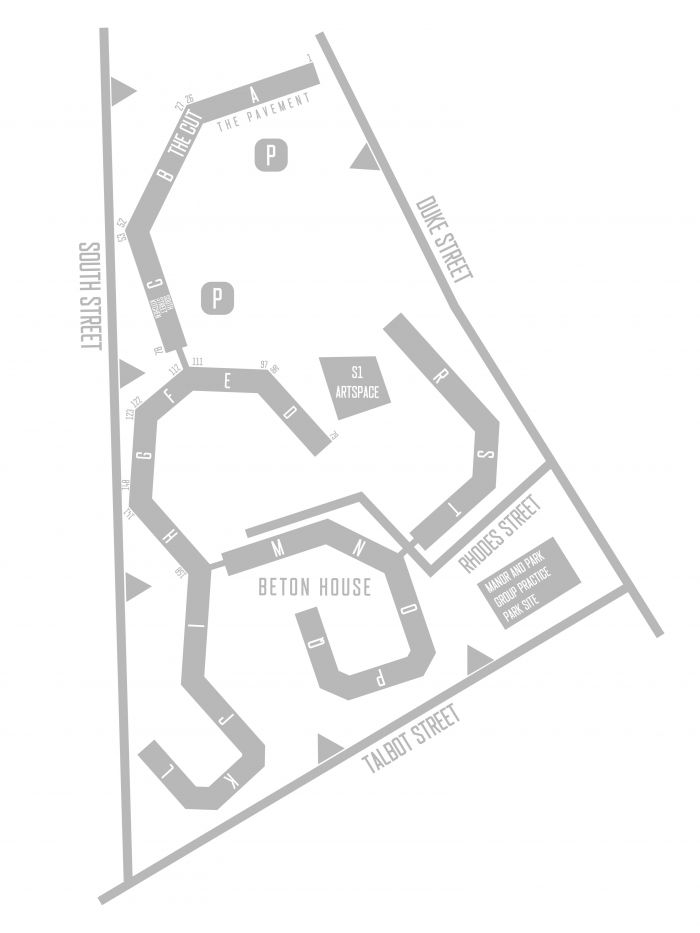
Residential buildings are annotated with Flank (letters) and property numbers (Phases 1 and 2 only). Access points to the estate are identified and other key locations are labelled. | Residential buildings are annotated with Flank (letters) and property numbers (Phases 1 and 2 only). Access points to the estate are identified and other key locations are labelled. | ||
[[File:Park Hill Map January 2021.jpg|left|frameless|933x933px]] | |||
[[File:Park Hill | |||
Revision as of 01:19, 14 January 2021
A simplified map of the Park Hill is displayed here.
Residential buildings are annotated with Flank (letters) and property numbers (Phases 1 and 2 only). Access points to the estate are identified and other key locations are labelled.
